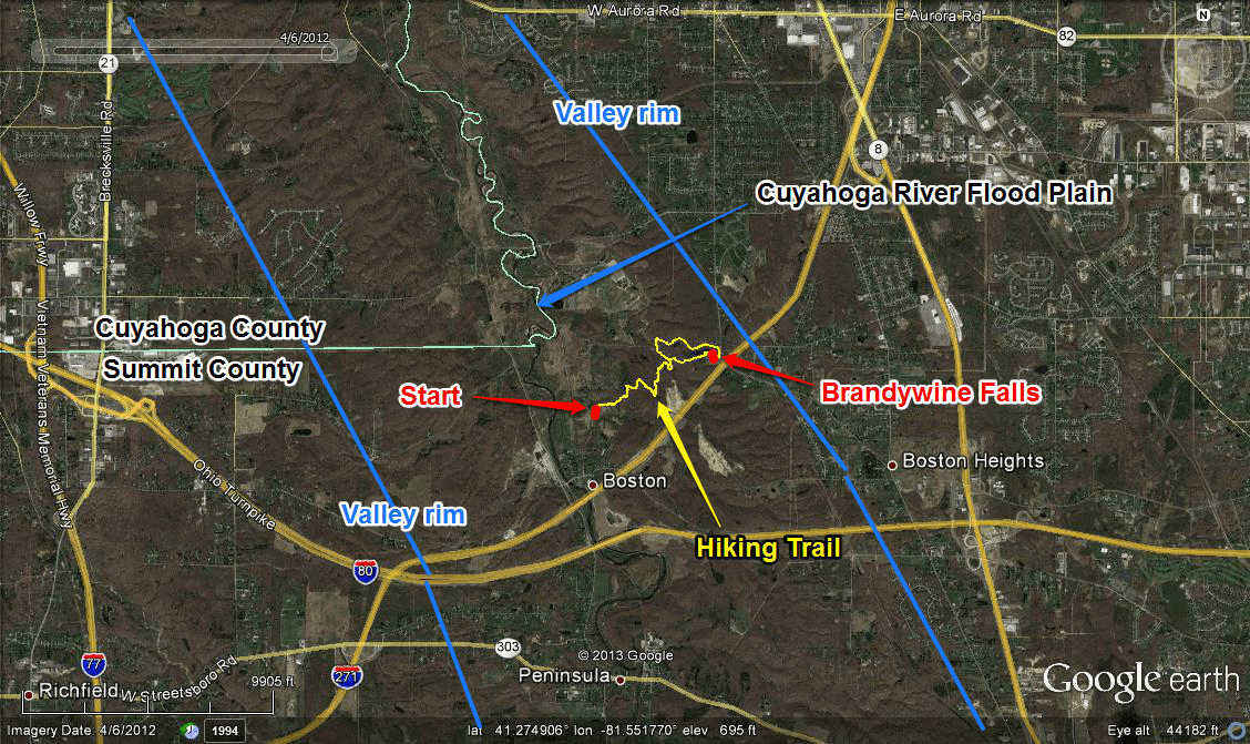
Aerial map of Brandywine Falls region. Graphics show the path of the hiking trail (yellow), the location of Brandywine Falls (red), as well as general constraints for the western and eastern edges of the Cuyahoga Valley (blue).

Aerial map of Brandywine Falls region. Graphics show the path of the hiking trail (yellow), the location of Brandywine Falls (red), as well as general constraints for the western and eastern edges of the Cuyahoga Valley (blue).
